Mapping Low-income Settlements
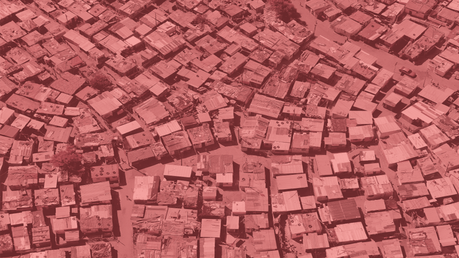
More than one billion people — a quarter of the world’s urban population — reside in informal settlements or slums. They often lack access to clean water, improved sanitation, and other infrastructure, live in overcrowded and unstable dwellings, and have no security of tenure. In sub-Saharan Africa, the world’s fastest urbanizing region, more than half of all urban dwellers live in these conditions.
Prompt and adequate policy responses to informal settlement formation is thus crucial for alleviating poverty and inequality. Yet, given their unplanned character and dynamic growth, it is difficult to track the emergence of informal settlements and measure the well-being of their inhabitants with existing monitoring systems. In this project, we make use of the increasing availability of high-resolution satellite imagery and advances in deep learning methods to identify and map urban informal settlements across sub-Saharan Africa.
The contributions of this project are threefold. First, we develop algorithms for data collation and preprocessing of high-resolution satellite images and make them publicly available to enable the wider research community to work with these datasets more easily. Second, we combine these satellite images with existing geo-referenced survey and census data and develop deep learning methods to train networks to identify informal settlements purely from satellite imagery. In this step, we explicitly incorporate the spatial and temporal correlation of the data to improve measurement and prediction performances. Third, we apply the trained networks to create high-resolution maps of the extent of informal settlements in African cities and their evolution over time. This novel dataset is then used to analyze the impacts of living in informal settlements on various socioeconomic and health-related outcomes.
Researchers: Kenneth Harttgen, Nicolas Büttner